

Al-Azhar Mosque
Al-Azhar Mosque is located within the walls of the area once known as Fatimid Cairo, between two districts rich in Islamic monuments: Al-Darb Al-Ahmar and Al-Gamaliya. Al-Azhar has served as both a mosque and a university for more than a thousand years. Although it was originally established to promote the Shiite doctrine when Egypt was conquered by Jawhar Al-Siqili, it currently teaches Islam according to the Sunni tradition.
Al-Azhar Mosque Museum on Google Maps
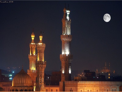
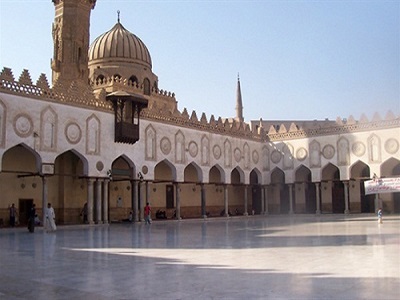
Ibn Tulun Mosque
Ibn Tulun Mosque is located in Ibn Tulun Square, near the Mosque of Sayyida Zeinab in the Sayyida Zeinab district. The Mosque of Ahmad Ibn Tulun is considered the third congregational mosque built in Islamic Egypt. Ahmad Ibn Tulun established it as a congregational mosque where Muslims could gather for Friday prayers. It covers an area of approximately six and a half feddans and consists of a square central courtyard surrounded by four arcades, the largest of which is the qibla arcade.
Ibn Tulun Mosque on Google Maps
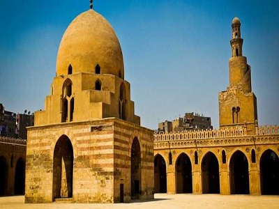
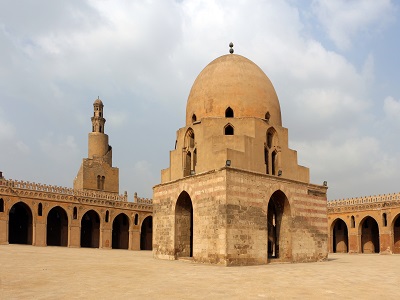
Mosque of Al-SalihTala'i
The mosque is located at the intersection of Al-Darb Al-Ahmar Street and Qasaba Radwan Street, opposite Bab Zuweila. It is also known as the “Hanging Mosque” because it is elevated above the ground, with shops underneath it that provide financial support for the mosque. This mosque is considered the last mosque built by the Fatimids in Cairo. It features beautiful Quranic inscriptions in Kufic script on its walls and columns. Beneath the mosque are shops that help cover its financial needs.
Mosque of Al-SalihTala'i on Google Maps
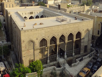
Abu Al-Dahab Mosque
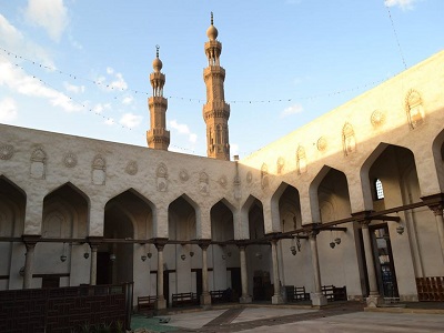
Abu Al-Dahab Mosque is located opposite Al-Azhar Mosque. The mosque was built by order of Muhammad Abu Al-Dahab in 1188 AH. It showcases a distinctive blend of Mamluk and Ottoman architectural styles, which can be observed in the magnificent decorations of its mihrab.
Abu Al-Dahab Mosque on Google Maps
Al-Rifa'i Mosque
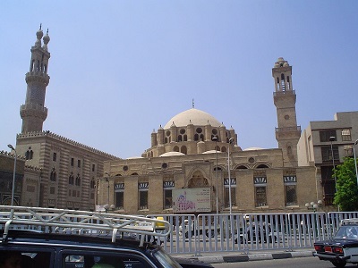
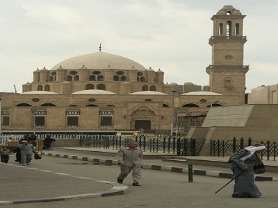
Al-Rifa’i Mosque was named after Ahmed Ezz El-Din Al-Sayyad Al-Rifa’i, one of the descendants of Imam Ahmed Al-Rifa’i. Khedive Ismail’s mother, Khoshiar Hanim, chose this small zawiya in 1869 so that it could later become a mausoleum for the remains of many members of the Muhammad Ali dynasty. Among the most famous of those buried there is her grandson, King Farouk, the last king of Egypt and the son of King Fuad, who was the son of Khedive Ismail.
Al-Rifa'i Mosque on Google Maps
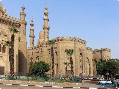
The Mosque and School of Al Sultan Hassan
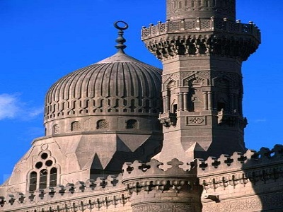
The Mosque and Madrasa of Sultan Hassan is located in Salah El-Din Square in the Citadel district. The mosque was built by Sultan Hassan, who was killed shortly before its construction was completed. The Mosque and Madrasa of Sultan Hassan is considered one of the most important and beautiful buildings representing the architectural art of the early Mamluk period in Cairo, an era renowned for its magnificent architecture.
The Mosque and School of Al Sultan Hassan on Google Maps
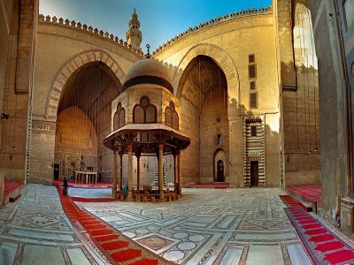
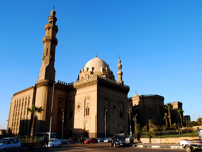
Al-Amir Shaykhu al-'Umari Mosque and Khanqah
This is a historic mosque built by Amir Shaykhu Al-Umari on Al-Saliba Street in Cairo in 1349. The mosque is distinguished by its magnificent interior design, decorated with black glass, wood, and marble, in addition to its unusual stone minbar. In front of the mosque is a khanqah (a place of worship) with a radial ceiling and white and blue tiles, further enhanced by beautiful Quranic inscriptions. The khanqah was built five years after the mosque.
Al-Amir Shaykhu al-'Umari Mosque and Khanqah on Google Maps
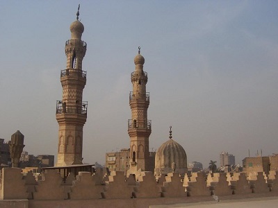
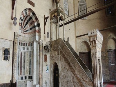
The Blue Mosque
The Blue Mosque, also known as the Mosque of Aqsunqur, is located in Old Cairo on the route from Al-Darb Al-Ahmar to the Al-Rifa’i Mosque. The mosque is distinguished by its walls covered with blue marble and floral-patterned tiles, particularly on the interior walls. These blue Ottoman-style decorations gave the mosque its name, the “Blue Mosque.”
The Blue Mosque on Google Maps
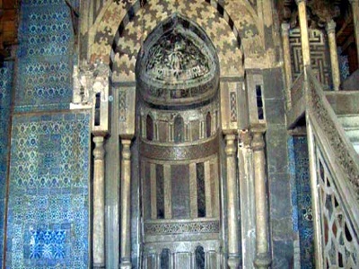
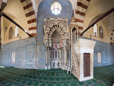
Amir Sarghitmish Madrassa and Mausoleum
It is a small building located near Ibn Tulun Mosque on Al-Saliba Street in Cairo. The madrasa was built in 1356 and served as a school, mosque, orphanage, and mausoleum after the death of Amir Sarghatmish. Most of the teachers who worked at this madrasa came from Persia, which led to the use of Persian styles in its architecture and interior elements.
Amir Sarghitmish Madrassa and Mausoleum on Google Maps
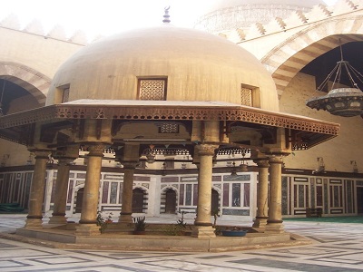
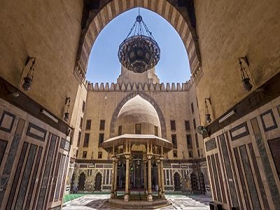
Beyt Zeinab Al-Khatoun
Zeinab Khatoun House is located behind Al-Azhar Mosque and was built in 1486 AD by order of Princess Shakra Hanim, the granddaughter of Sultan Al-Nasir Hassan ibn Qalawun, one of the Mamluk sultans. It was named after Zeinab Khatoun, the wife of Prince Sharif Hamza Al-Kharboutli, who purchased the house for her to live in.
The house consists of a spacious, open central courtyard overlooking the men’s seating area, known as the “Salamlik,” through wooden mashrabiyas. The women’s quarters, known as the “Haramlik,” are located on the second floor, while the third floor contains the bedrooms.
Beyt Zeinab Al-Khatoun on Google Maps
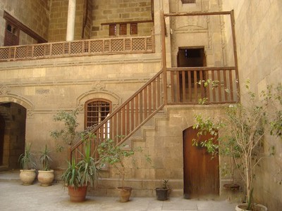
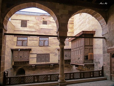
Beyt Al-Harrawi
Al-Harawi House is part of a unique group of Islamic houses in the Al-Azhar area. It is located next to Set Wasila House and overlooks Zeinab Khatoun House. In 1996, a ministerial decree was issued to transform it into an artistic creativity center affiliated with the cultural development fund. Since then, the house has become both an archaeological and artistic attraction. It also served as the headquarters of the “Arabic Oud House.”
Beyt Al-Harrawi on Google Maps
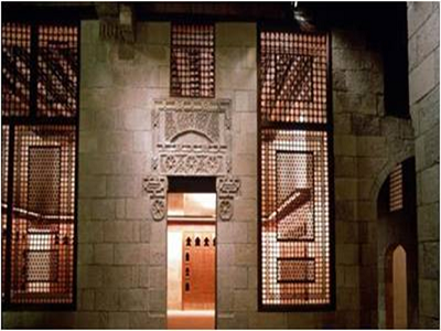
Magra Al-Oyoun Aqueduct
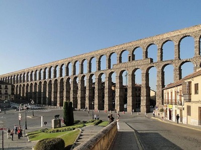
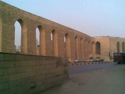
The Aqueduct Wall, known as Sur Magra El-Eyoun, is located in the Old Cairo area and extends from the mouth of the Gulf to Bab Al-Qarafa in Sayyida Aisha. It was built by engineers during the reign of Sultan Qalawun approximately 800 years ago to supply the Citadel of Saladin with water by raising Nile water through waterwheels to the aqueduct. At that time, the Citadel was the seat of government in Egypt during the Ayyubid era. The wall consists of the Intake Tower, a structure containing six waterwheels, which is why it was formerly known as the “Seven Waterwheels.”
Magra Al-Oyoun Aqueduct on Google Maps
Virgin Mary's Tree
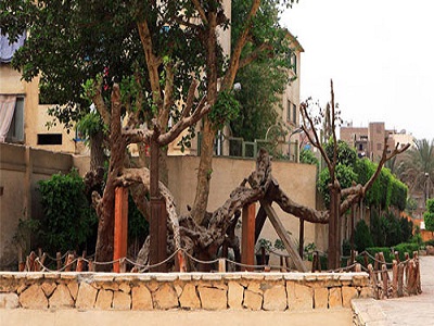
The Virgin Mary’s Tree is located on Al-Balsam Street in Al-Matariya, near the Senusret Obelisk. The tree is considered sacred because it is believed to be the tree under which the Holy Family sought shelter during their stay in Egypt. It is also said that the trunk of the tree opened to protect them from bandits who were pursuing them. Since then, the tree has been known as the “Virgin Mary’s Tree.”
Virgin Mary's Tree on Google Maps
Prince Taz Palace
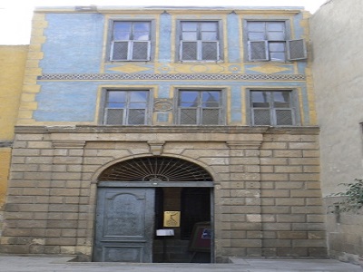
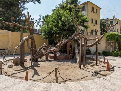
Prince Taz Palace is located in the Khalifa district, in the Citadel area, on Al-Suyufiya Street, which branches off from Al-Saliba Street. Prince Taz Palace is a magnificent yet silent building that has suffered greatly over the years, as only a small part of it remains. When it was originally built, the palace consisted of a large central courtyard that served as the palace garden, with the various sections of the palace arranged around it.
Prince Taz Palace on Google Maps
Mostafa Kamel Museum
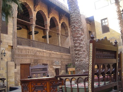
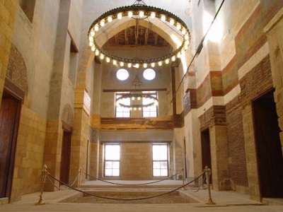
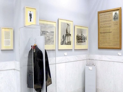
The Mustafa Kamel Museum is located in Salah El-Din Square in the Citadel. It was previously a mausoleum containing the remains of the two national leaders, Mustafa Kamel and Mohammed Farid. The museum was officially opened in April 1956. It consists of two large halls containing many personal belongings, most notably books and letters written by Mustafa Kamel in his own handwriting, as well as photographs of some of his friends and relatives.
Mostafa Kamel Museum on Google Maps
Nilo meter
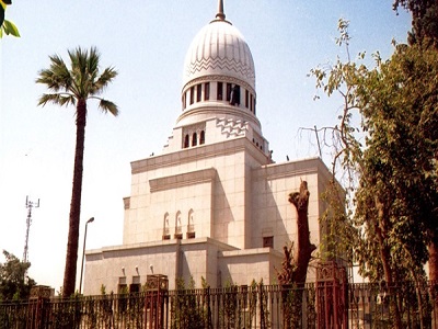
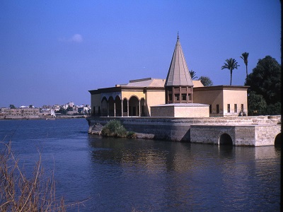
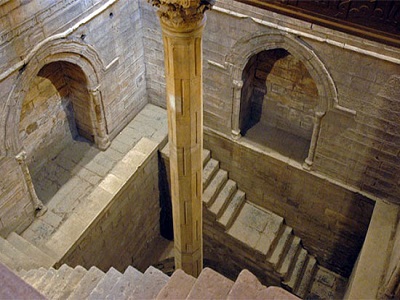
The Nilometer is located at the southern end of Roda Island in Cairo. It was used in the past to measure the water level of the Nile River. It was built during the Abbasid era and underwent several restoration projects during the Tulunid, Fatimid, Mamluk, and Ottoman periods.
Cairo Tower
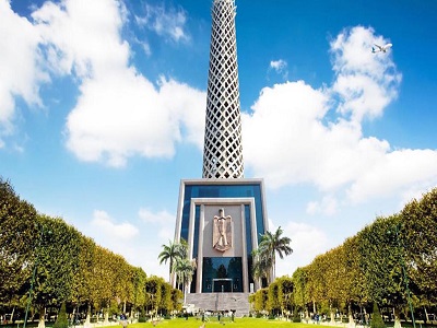
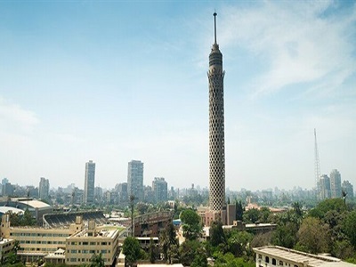
Cairo Tower is located in the heart of the capital on Zamalek Island in the Nile River. It is considered one of Cairo’s most prominent landmarks. The tower was designed by the late architect Naoum Shebib and was constructed of reinforced concrete in the shape of the Egyptian lotus flower, which is one of the symbols of Pharaonic civilization and a major attraction for tourists from around the world.
6th of October Panorama
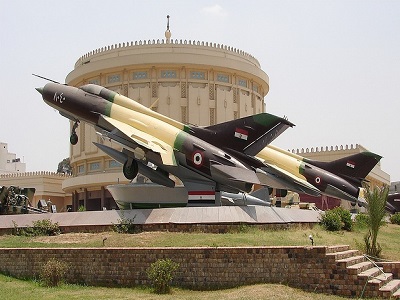
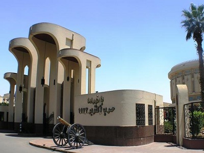
The October War Panorama is located on Salah Salem Street, opposite the Al-Obour Buildings. The Panorama was inaugurated on October 5, 1989. It is one of the museums that commemorates one of Egypt’s greatest victories, highlighting the achievements and heroism of the soldiers and martyrs of the October War who contributed to this great victory.
6th of October Panorama on Google Maps
Cairo Opera House
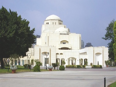
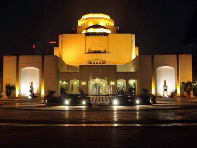
The Egyptian Opera House is currently located in its new building on the grounds of Gezira Island in Zamalek. The building was constructed as a grant from the Japanese government to the Egyptian government. The new Egyptian Opera House is the “National Cultural Center” and one of the most important cultural landmarks in Egypt. Since its establishment in 1988, it has presented fine arts and a wide range of creative activities.
Cairo Opera House on Google Maps
Unknown Soldier memorial
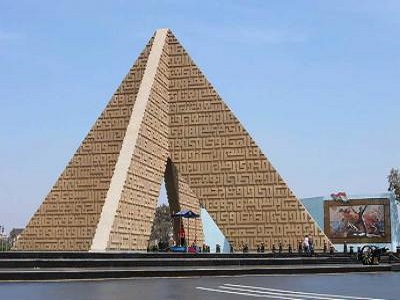
The Unknown Soldier Memorial is located in Nasr City, Cairo. It is a pyramid-shaped concrete structure built following Egypt’s October 1973 victory to commemorate the sacrifices of the brave Egyptians. The idea for establishing the memorial dates back to October 1974, during the first anniversary of the October 1973 War, when President Anwar Sadat ordered the construction of a memorial containing the remains of one of the war’s martyrs.
Unknown Soldier memorial on Google Maps
Egyptian National Library and Archives
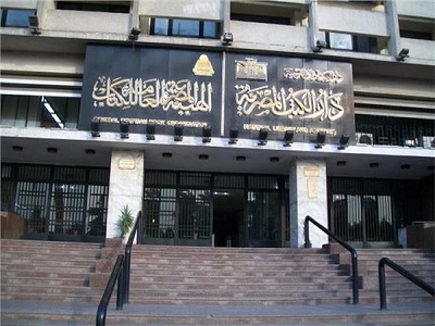
The National Library and Archives Authority is Egypt’s national library. It comprises several departments distributed across two locations: the first and oldest is in Bab Al-Khalq Square, while the other is located on the Nile Corniche in Ramlet Boulak. The National Library was established by Ali Mubarak under a decree issued by Khedive Ismail. It serves as Egypt’s national archive, housing ancient manuscripts, national documents, as well as rare and important books.
Egyptian National Library and Archives on Google Maps