Cairo
modern streets
Streets are the
memory of our nation, holding tears, smiles, setbacks, and victories that
linger as long as history lasts and trace remains. Today, we will explore the
history of one of Cairo's most important arteries: Al-Galaa Street.
Al-Galaa Street,
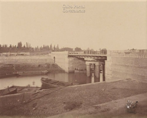
formerly known as the Al-Tera’ Al-Boulqia, is named after the canal that
extended from the Nile River, specifically at the location of the current Radio
and Television Building, to the Shubra farms.


Regarding the
current name of the street, it was named by the leaders of the July 1952
Revolution as part of their efforts to change the names of streets in Cairo.
They replaced them with names reflecting revolutionary themes, such as Al-Galaa
and Al-Tahrir. The Galaa Street connects two of the widest and busiest squares
in Cairo: Tahrir and Ramses squares.
On the other hand,
The Galaa Street bridges two contrasting worlds: the "European
Cairo," or Khedivial Cairo, and the world of Boulaq, or "the former
Port of Boulaq."
Al-Galaa Street
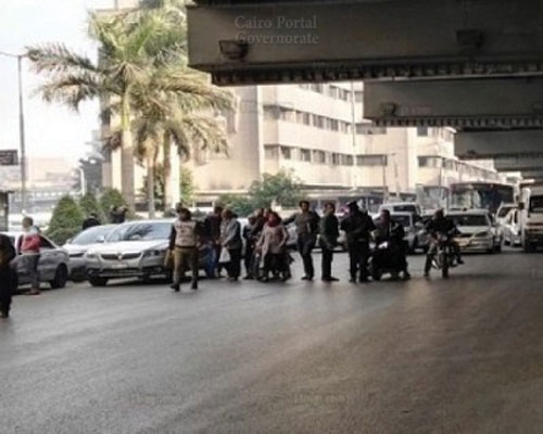
boasts many unique features, the most notable of which is that it is one of the
rare covered streets in Egypt. However, this is not a ceiling in the
conventional sense, but it was part of one of the construction phases of the
6th of October Bridge. The bridge spans Al-Galaa Street from its beginning at
Ramses Square to its end at Abdel Moneim Riad Square, where Al-Galaa Street
ends.


Despite the street’s
narrow nature, it is home to many famous and prominent institutions in Cairo,
such as the Red Crescent Hospital, the Azbakia Police Station, the Egyptian
Trade Union Federation building, the General Authority for Health Insurance,
Al-Galaa Courthouse, Akhbar Al-Youm Foundation, Al-Ahram Foundation, the
Kalousdian Armenian School, the Greek Church, Al-Galaa Maternity Hospital, and
the Ambulance Pharmacy.
Ramses Street is the longest and
most crowded street in Cairo. It is also the main artery connecting many of
Cairo districts. Ramses street extends from Tahrir Square to Abbasia Square.
Reasons
behind the name
At first, Ramses street was known
as Abbas street after Khedive Abbas Helmy, who ruled Egypt in 1892. After
Khedive Abbas died, the street’s name was changed to El-Malika Nazli, the wife
of King Fouad II. Later, King Farouq shortened the name to El-Maleka Street because
of the bad reputation of his mother. Then in1962, after placing the sculpture
of Nahdet Masr “Rise of Egypt” by the Egyptian sculptor Mahmoud Mukhtar in
Ramses square, the street became known as Nahdet Masr Street. After the 23rd of
July revolution in 1955, the sculpture was moved to Cairo University square, and
Ramses II statue was placed instead. Since then, the street retained the name
of Ramses despite moving Ramses statue to the Grand Egyptian Museum in Giza in
2006.
Landmarks
Ramses street houses many of
Cairo’s significant government institutions such as the Lawyers Syndicate,
Egyptian Chemistry Administration, Sadat Academy for Management Sciences (SAMS),
Arab Music Institute, Administration Development Bank, and Egypt National Railway.
Ramses Street on Google Maps
Mohammad Mazhar
Street
Mohammad Mazhar Street is one of
Zamalek area most famous streets. It runs from 26th July
intersection to Geziret El-Zamalek.
Name
Mohammad Mazhar Street was named
after the brilliant Egyptian engineer Mohammad Mazhar Pasha. Mohammad Mazhar
Pasha was chosen by Mohammad Ali Pasha to be part of the study mission he sent
to France in 1826 to study marine engineering. When he returned to Egypt, he
was appointed as a headmaster of the artillery school. He also built the
Lighthouse of Alexandria upon the request of Mohammed Ali Pasha and
participated in establishing El Qanater El Khayreya.
Landmarks
Mohammad Mazhar Street is home to
many embassies like Algerian Embassy and Vatican Embassy. There is also the
Greater Cairo Library which used to be the palace of Samiha Kamel, daughter of
Sultan Hussein Kamel.
El-Sheikh Rihan
Street
El-Sheikh Rihan Street is another notable
street in Cairo and is the flowing artery from the heart of European Cairo. The
Street extends from Simón Bolivar Square to Port Said Street.
Name
El-Sheikh Rihan Street was named after El-Sheikh Rihan, whose shrine lies at a
corner in the middle of the Street. Historians argued
whether it took its name from Abu Rihanna, one of Prophet Mohammad’s companions
or Rihan ibn Yousef, a descendant of Imam Hussein ibn Ali. In 1917, The Street
was called El-Sultan Hussein Kamel, the Sultan of Egypt and Sudan who ascended
the throne in 1917. After the 23rd of July revolution, the Street
restored its old name El-Sheikh Rihan.
El-Sheikh Rihan Street on Google Maps
Sabri Abu Alm
Street
Sabri Abu Alm Street runs from
Talaat Harb Square to Mohammad Farid Square. In the past, it was called Gerks street
after the Gerks mosque which was built by the Mamluk Prince Gerks. Then in
1947, the Street’s name was changed to Sabri Abu Alm Street after Mohammad
Sabri Abu Alm Pasha, one of the Egyptian leaders who played a vital role in the
political life in Egypt. Mohammad Sabry graduated from Law School in 1971, and
he was appointed Minister of Justice in 1942. He also participated in the
committee that prepared the two draft laws of abolishing capitulations and the
independence of the judiciary in Egypt. Moreover, he was Secretary-General of
Al-Wafd Party and the owner of “Sout Al-Umma” newspaper.
Salah Salem
Street
Salah Salem Street in Cairo is Egypt’s
most famous streets ever. The Street is
known far and wide because it is connecting many of Cairo’s areas that lead to
the main bridges of the city.
Location
Salah Salem Street runs from Cairo airport
to El-Malek El-Saleh tunnel. The Street is one of Cairo’s longest streets passing
through three areas which are Madinet Nasr, Masr El-Gadidah, and El-Abbasia. Salah
Salem is a two-way street, and it was built by Abdel El-Latif Al-Baghdadi on
instruction from the Egyptian President Gamal Abdel Naser in the 1950s. It was
called then El-Tariq El-Harbi Street, and most of its lands were cemeteries. It
was like a traffic circle whose middle phase lies on the outskirts of Cairo.
Name
Salah Salem street was named after
one of the Egyptian free officers as the day in which Abdel El-Latif Al-Baghdadi
finished the construction of Salah Salem road marked the anniversary of the
officer’s death. Salah Salem was of Sudanese origin, and he lived in Cairo
since childhood. He graduated from Military School
in 1940. After the 23rd of July revolution, he commanded the
Egyptian army forces in Sudan. Salah Salem was also a politician and played an
important role in signing the agreement of 12th of February with
Britain on Sudan. After he quit politics, he worked in journalism.
Landmarks
Salah Salem Street houses Oruba
Palace, Baron Palace, and other significant places like the Cairo Stadium, the
Egyptian Military Academy, Ministry of Defense, and the Cairo Airport.
Qasr El-Nil
Street
Qasr El-Nil Street is one of the main
arteries in the heart of Cairo. It is where the Egyptian army built their
barracks and the hangout of Egyptian elites. The street was also the cradle of political
conflict in Egypt.
Location
Qasr El-Nil Street extends from Tahrir
Square, passing by Talaat
Harb Square and Mustafa Kamel Square and ends on Oprah Square.
Name
Qasr El-Nil is the only street that retained its first
name which is associated with the palace built by Mohammed Ali Pasha for his Daughter
“Nazly Hanem”, on the Nile. Then Said Pasha built army barracks in the area. In
1950, the barracks were demolished and replaced by Arab League headquarters and
Nile- Ritz Carlton Hotel.
Landmarks
In its early days, Qasr El-Nil Street
was the headquarters of the Egyptian army because it was close to Qasr El-Ainy
Street, home to palaces of royalty and dignitaries at this time. Being an
important military and political site made it an aspiration for the British
occupation. So, when the British forces arrived in Egypt, they occupied the
Egyptian army barracks on Qasr El-Nil street, and after the evacuation of the
British troops, King Farouq raised the flag of Egypt on
Qasr El-Nil’s army barracks.
Later, the street developed to be one
of Cairo’s iconic streets housing several stores like Chalons, Sidnawy, Benzoin;
companies such as Almasnoat Almasryia Company; banks like Bank Misr, and
National Bank of Egypt. It also houses
two of Cairo’s historic El-Imobilia building and Wahba building as well as
Mamar Behlar “Behar passageway” which is the most famous in Cairo. It was named
after a Swiss businessman Charles Behlar, the founder and owner of several real
estates and hotels in Cairo. The passageway was modelled after the French
shopping streets.
Significance
The construction of this area is
attributed to Ibrahim Pasha, son of Mohammad Ali Pasha, who ordered the
pavement of the land extending from Abu El-Ela Bridge in the north to Qasr
El-Nil Bridge in the south. Then in 1882, Khedive Ismail assigned genius
Egyptian architect Ali Mubarak to design Qasr El-Nil Street. The street has
distinctive architectural style and artistic decorations that imitate the
European one that emerged in Europe during the second half of the 19th
century.
Qasr El-Nil Street on Google Maps
Abdel Aziz Street
extends from Abdeen Palace to Ataba Square. It was established to connect
Abdeen Palace, the seat of government then, with Khedive Abbas's Palace in
Ataba Square. The street was named
after Sultan Abdel Aziz, Sultan of Turkey, commemorating his fruitful visit to
Egypt in 1863 during the reign of Ismail Pasha.

In its early days,
Abdel Aziz Street was a model of urban coordination and artistic beauty, but it
has now transformed into Cairo's most famous commercial street.
Significant
visits and special privileges for Khedive Ismail
Sultan Abdel Aziz’s visit was the first of an Ottoman
sultan to Egypt following Sultan Selim's conquest of the country in 1517. Upon
the arrival of Sultan Abdel Aziz in Alexandria, Ismail Pasha welcomed him
personally. Abdel Aziz stayed at Ras El-Tin Palace for two days before
traveling by train to Cairo. It was the first time the sultan saw a train.
Egypt was the first to build a railway in Africa during the reign of Abbas I in
1852, in agreement with Robert Stevenson, the inventor of the steam locomotive.
Additionally, the Cairo-Alexandria line is the first railway line in the entire
region.
In Cairo, the sultan stayed at Salah El-Din Citadel
Palace and performed Friday prayers at the Mosque of Mohammad Ali. He also witnessed
the parade of Kiswat Al-Kaaba departing from Egypt to Mecca.
During this visit, Ismail Pasha strengthened his
position to achieve his ambitions. So, he was granted new rights, privileges,
and several royal decrees to consolidate his power. Firstly, the monarchy in
Egypt was restructured to pass to Ismail's eldest son rather than the eldest
member of the Muhammad Ali family, per the Farmān issued on June 8, 1867. Then,
Ismail Pasha was bestowed the title of Khedive, as per the Farmān of May 27,
1866, elevating his ruler’s position to a rank closer to that of kings and
sultans.
From unique architectural style to Cairo’s most famous
commercial streets
Over time, commercial activity flourished on Abdel
Aziz Street, featuring a series of stores. One of the most famous was the Omar
Effendi store, located at the intersection of Abdel Aziz and Rushdi Streets
(formerly Al-Saha). The store is named after its Turkish owner.

Later, with the onset of World War I (1914–1918),
Turks liquidated their properties in Egypt. Then, a French merchant named
Orosdi Back purchased the store. Orosdi Back retained the original name due to
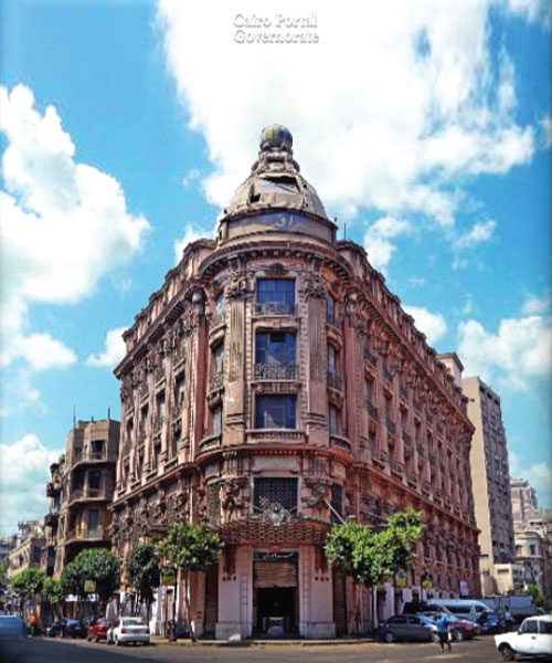
its wide fame. The building features a dome above the entrance with a lantern
that rotates in the evening, illuminating the skies of Cairo. The store became
renowned for the Omar Effendi lantern, which lit up at night to announce sales,
attracting customers to the store.
That marked the beginning of commercial activity, and
after several years, the furniture trade spread throughout the street. Then, it
became home to Egypt's most renowned furniture showrooms. It attracted wealthy
customers, as they displayed expensive and imported goods. Among the most
famous were the Sablaji Pasha Store, Al-Farnawani Pasha Store, and Ali Bey
Al-Samari Store.
The furniture shops dominated the street until the
early 1990s. Afterwards, the street shifted its business activity to electrical
appliances, becoming a hub for many across Egypt.
Due to the rapid changes in commerce, the emergence
and spread of mobile phones prompted merchants to change their business focus.
This shift has transformed the street into a primary hub for mobile phones,
accessories, and used devices, making it one of the busiest markets in the
capital.
Last Update: 2024


